


Maghull to Burscough
12- 24 miles
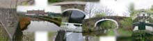
Burscough
to Wigan
24 - 34 miles
Former Lancaster Canal South
37-47miles
Johnson's Hillock to Cherry Tree
47 - 54 miles
Map of the Leeds & Liverpool Canal
This page loads maps hosted on googlemaps, it may be slow to load for some users. To see a list of maps available click here.
Route Map
View Larger Map on Google Maps
Map of the Leeds and Liverpool Canal including branch lines and the new dock link in Liverpool.
Leeds Liverpool Canal Bridges
Part One (West)
View Larger Map on Google Maps
Map showing the Bridges of the Leeds and Liverpool Canal between Liverpool and Blackburn
Part Two (East)
View Larger Map on Google Maps
Map of bridges on the Leeds & Liverpool Canal between Blackburn and Bingley
Part Three Bingley to Leeds
View Larger Map on Google Maps
Map of Canal Access Points and Features.
View Leeds & Liverpool Canal: Access in a larger map
Map of World War Two Defences of the Leeds & Liverpool Canal
View World War Two Defences Lancashire in a larger map
Canal Pubs
View Canal Pubs in a larger map
Shipley to Leeds
115 -125 miles
Stockbridge to Shipley
109 -115 miles
Skipton to Stockbridge
99 - 109 miles
Gargrave to Skipton
93 -99 miles
Greenberfield to Gargrave
87 - 93 miles
Foulridge to Greenberfield
82 - 87 miles
