|
|
|
|
Tavistock is on the National Cycle Network. Route #27 is the Devon Coast to Coast. There are a number of cycle routes in and around Tavistock and a leaflet of these routes can be found at the tourist information office in town. |
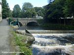
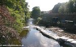
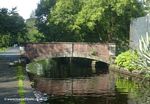
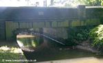
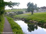
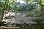
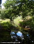
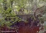
The 1897 book "Highways and Byways in Devon and Cornwall" by Arthur H. Norway, describes Tavistock: "Tavistock is certainly a very lovely town. It is set in a deep valley of rich pastureland around the banks of the River Tavy, sheltered by dense woodlands over which the hills rise bare and rugged. Turn where you will in the old town streets, you will see the wild downs rising over these lovely woods and hear the noisey river singing over stones and boulders of all the wonders it has seen upon the moor. This sound of rushing water fills the town. [Abbey] bridge is the true centre of the town of Tavistock, a wonderous place for reflection and romance. Here idleness is a virtue; and he is the bad man who hastens by with no more than a passing thought for the brown water foaming under the old bridge, the dark pools round which it swirls, the trailing ivy which hangs in the cool shadow of the arches, the weir over which the river boils a few yards further on, the salmon ladder by its side, and the leaping of the fish in the still pool beyond. Black and broken by white rapids, the river hastens on, flashing over boulders beneath an avenue of high elms trees, through which the hot sunshine falls in dapples on the water; and sweeping sidewards is lost among the meadows." |
 |
 |
 |
|
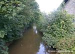
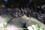
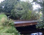
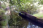
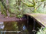
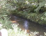
| The River Tavy at Abbey Bridge |
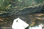
The River Tavy from Abbey Bridge |
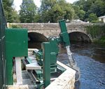
Automatic Screening Device |
|
 |
 |
 |
 |
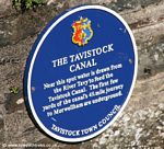
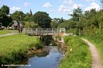
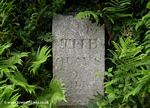
| Tavistock Canal Plaque |
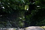
Canal Feeder Channel |
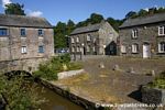
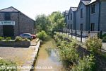
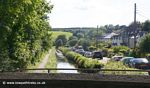
Tavistock Wharf |
Tavistock Wharf |
 |
 |
 |
 |
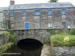
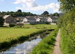
| Tavistock Wharf |
Canal Road |
Looking towards Canal Wharf |
Looking towards The Meadows |
 |
 |
 |
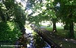 |
| Bridge in the Meadows |
Bowling by the Canal |
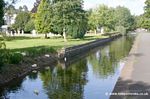
The Meadows |
The Meadows |
 |
 |
 |
 |
| West Bridge |
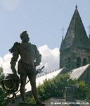
Sir Francis Drake |
|
From West Bridge |
 |
 |
 |
 |
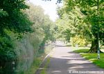
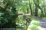
| Along the Canal |
'Swing' Bridge |
Looking towards Tavistock |
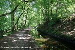
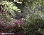
Crowndale Woods |
 |
 |
 |
 |
| In Crowndale Woods |
A fridge |
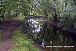
Canal Edge |
Canal Edge |
 |
 |
 |
|
| canal edge |
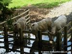
Drinking Bullocks |
Crowndale Woods |
|
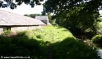
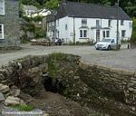
Crowndale Farm was established in the mid-15th Century and pulled down in the 1850's its stone being used to build the Manor House at Lewtrenchard, 8 miles north. Crowndale Farm is said to be the birthplace of Sir Franci Drake, although the actual site of his borth is disputed. Drake is famous for his role in defeating the Spanish Armada in 1588. The buildings you can see today are much later. The long building beside the towpath is a warehouse for goods transported by canal. |
 |
 |
 |
 |
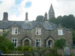
| Crowndale Farm |
Crowndale Farm |
Canal at Crowndale |
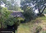
Canal Bridge |
 |
 |
 |
 |
| Under the Bridge |
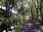
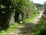
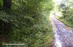
Looking along the towpath |
The canal near Shillamill |
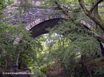
Aqueduct |
 |
 |
 |
 |
| Aqueduct |
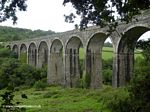
Railway Viaduct |
Passing under the Viaduct |
The lock narrows |
 |
 |
 |
 |
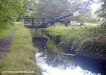
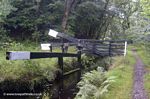
| Lock Gate and Lift Bridge |
Lock Keepers Cottage |
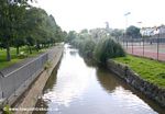
The canal approaching the junction has a towpath on both sides |
Canal Junction |
 |
 |
 |
 |
| Closed Gate |
End of the Line |
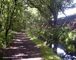
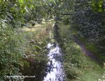
Along the canal |
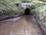
Towards the Tunnel |
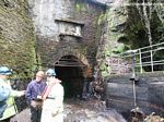
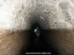
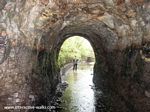
Work began on both ends of the tunnel in 1803. The tunnel is 160yards from the top of the hill and nearly one and three-quarter miles long. It took 14 years to complete the tunnel, blasting with powder. A narrow tunnel was driven through then enlarged, with shafts going up to the surface. A waterwheel was used to pump water out of the tunnel. The two ends met in August 1816 and the tunnel completed in 1817. The spoil from the tunnel excavations was used to build the canal embankment over the Lumburn Valley.
Laden boats could take 3 hours to pass through the tunnel going against the current. There is no towpath so boatmen either lay on their backs and walked it through with their hands and feet on the tunnel roof, or used poles to push boats. In the 1850's there was a plan for a steam engine to pull boats through. Water wheels were tried using wires to pull boats. Navigation through the tunnel was free but rates of tonnage were charged depending on the cargo. |
 |
 |
 |
 |
Tunnel Entrance
Tavistock side |
In the drained tunnel |
Leaving the tunnel |
Tunnel Entrance
Morwellham side |
The tunnel photographs come from www.interactive-walks.com visit the site for a virtual walk along the canal and through the whole tunnel. As well as the hundreds of photographs of the canal there are photos of the town of Tavistock and surrounding area. |
The canal emerges from Morwel Down through a stone-faced tunnel arch eight feet high and six feet wide. Above the tunnel entrance is the date work started on the tunnel, 1803. There is a short stretch of canal up to Canal Cottage, unfortunately this is closed to the public. From there the cargo was transfered to the quayside below via an inclined plane railway.
From the tunnel entrance there is a channel taking canal water to the Morwellham Power Station (hydroelectric) built in 1933 by the West Devon Electric Supply Company. |
 |
 |
 |
 |
| Morwell Down Tunnel |
Canal channel |
Canal channel |
Trees and Ferns |
 |
 |
 |
 |
| water channel to the hydro plant |
sluice gates |
iron rail |
slate railway sleeper |
 |
 |
 |
 |
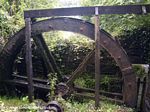
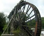
| WaterWheel |
Incline Keepers Hut |
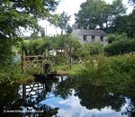
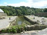
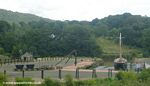
Dock at Morwellham Quay |
A dock at Morwellham Quay |
 |
 |
 |
 |
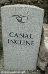
| Canal Incline Sign |
Morwellham Quay |
Waterwheel |
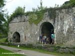
Lime Kilns |
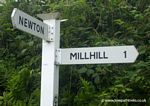
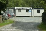
The Mill Hill Branch was built to link the Mill Hill Quarries to the Tavistock Canal. The junction is on the south west side of the aqueduct. The branch had an inclined plane with a rise of 19 feet 6 inches. The branch was fed from the River Lumburn but it was difficult to sustain the water supply on the upper reaches. The branch was closed in the 1830s and in 1844 replaced by cast iron tramway. Today the branch is little more than a damp over grown ditch. For most of the route there is now no sign of the canal. There is one stone bridge taking the road over the line of the canal at Artiscombe. At Mill Hill there are more Bedford Cottages and a former canal warehouse. |
 |
 |
 |
 |
| The end of the Mill Hill branch |
The Mill Hill Cut |
The Canal and Towpath/Tramway |
On the road to Mill Hill |
 |
 |
 |
 |
| One Mile to Mill Hill |
Canal Bridge |
Mill Hill |
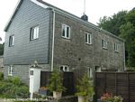
Bedford Cottage |
 |
 |
|
|
| Canal Warehouse |
Mill Hill Quarries |
|
|