


Maghull to Burscough
12- 24 miles
Burscough
to Wigan
24 - 34 miles
Former Lancaster Canal South
37-47miles
Johnson's Hillock to Cherry Tree
47 - 54 miles
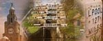
The Leeds & Liverpool Canal
This is a guide to walking or cycling the towpaths of the Leeds & Liverpool Canal which runs 127.25 miles from Liverpool to Leeds. Click the links to the left and right to see the photographs of the Leeds & Liverpool Canal. Follow the photos down the page to go from Liverpool to Leeds. You can click on each photo to get a larger image and more information.
View Larger Map in Google Maps
Double click to zoom in, click here to see more maps
Construction of the Leeds & Liverpool Canal was started in 1770 and the canal was finally completed in 1816. Originally limestone was expected to be the main cargo but coal became the most important cargo and coal carrying continued until the 1970s. The canal linked the textile towns of Blackburn, Burnley, and Bradford to which wool and cotton were imported from the docks at Liverpool. Manufactured goods were transported along the canal and via the port of Liverpool to the whole of the British Empire. Both Leeds and Liverpool have under gone regeneration in recent years and both have a lot to offer visitors.
Shipley to Leeds
115 -125 miles
Stockbridge to Shipley
109 -115 miles
Skipton to Riddlesden
99 - 109 miles
Gargrave to Skipton
93 -99 miles
Greenberfield to Gargrave
87- 93 miles
Foulridge to Greenberfield
82-87 miles
Burnley Lane to Foulridge Tunnel
75 -82 miles
Rishton, Church and Hapton
59 - 71 miles