Click on the photographs to see a larger image and more information |
blogs:  |
route map:  |
access map:  |
|
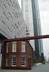
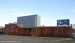
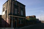
The original terminus of the Leeds & Liverpool Canal in Liverpool was around Old Hall Street. The canal passed under the road to a basin on the river-side. Clarkes Basin, built 1792 and closed in 1886, was the closest link the canal had to the dock system until the Stanely Dock branch was built in 1846. Cargo would have to be transhipped from boat to wagon and then taken to the docks. All that remains of the former canal basin is a small brick building, now dwarfed by the hotel and tower block behind it. This was once a coopers yard. The canal is also remembered in the street names: Old Leeds Street and Leeds Street. This area is now the business centre of Liverpool with many insurance companies and the headquarters of the Liverpool Echo nearby.
|
 |
 |
 |
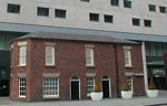 |
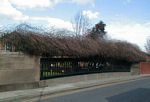
To accommodate the expansion of the railways part of the canal was in filled in 1886 leaving Clarke's Basin stranded and unused. The canal between the "New Basin" (just south of the Chisenhale Street bridge) and the Philips Street coal yards basin was re-built, it was straightened and moved about 50 meters east. The Pall Mall Warehouses were built along side, with new canal offices. The canal went right up to the warehouses to allow cargo to be loaded/unloaded directly. Large doors allowed goods wagons access to the warehouses from the new Pall Mall road. The other side of the basin was taken up with coal yards and the council rubbish incinerator, there were arms off the basin for loading and unloading.
The company headquaters were damaged during World War Two, the paper work was moved to company offices elsewhere and the canal was run from a house in nearby Formby. There was also a mission for canal workers at the terminus which gave the bargemen somewhere to be educated and even practice rifle shooting.
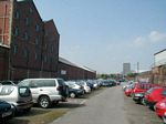
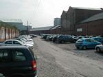
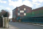
The terminus basin was filled in up to Chisenhale Street in the 1960s. The once open side of the warehouses was bricked up. The basin is now a car park and the arms have been built on. Some warehousing was demolished when Leeds Street was widened.
|
 |
 |
|
 |
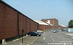
| Site of the canal terminus warehouses |
L'Pool 0 Miles
Leeds 127¼ Miles |
|
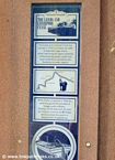
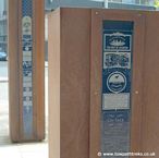
Quayside Stones |
 |
 |
 |
 |
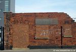
| the former canal basin |
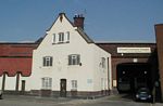
the white building is the foreman's house at the Pall Mall Basin |
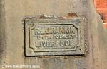
R&J Rankin Iron Foundry Liverpool, makers of the metal door ways. |
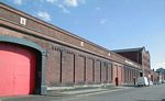
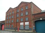
Pall Mall Warehouses |
 |
 |
 |
 |
| Warehouse on Pall Mall |
the site of the Liverpool and Wigan Canal Mission which was formed in the 1860's. |
the frontdoor of the Liverpool and Wigan Canal Mission, 1908 |
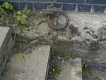
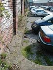
Old mooring ring on the edge of the warehouse |
 |
 |
 |
 |
| The edge of the former canal basin |
The former canal basin looking north towards Chisenhale Street |
The former canal basin looking south towards Leeds Street |
Mooring ring on the side of the basin. |
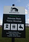
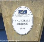
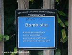
In 1978 a local housing group from Eldonian Street were told they were to be re-housed and the community split up. They protested and the Eldonian Village plan was created. The area was cleared of its housing and industrial buildings. The demolition of the Tate and Lyle refinery as shown in the Boys from the Black Stuff marked the end of the canal as an industrial feature. The canal was shortened yet again this time to just north of bridge B Burlington street bridge. The Eldonian Basin was created with the Eldonian Village Hall and sports centre. www.eldonians.org.uk A new bridge was built to give access to the housing estate as part of Phase II of the regeneration. This new bridge, Vauxhall Bridge was opened by former local Cilla Black.
|
 |
 |
 |
 |
| Bridge Inn besides Chisenhale St. Bridge |
North side of Bridge A |
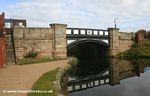
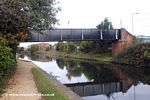
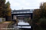
Chisenhale Street Bridge
Bridge A |
South side of Chisenhale Street Bridge |
| |
 |
 |
|
| |
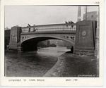
Chisenhale Street Bridge ~1900 |
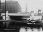
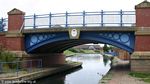
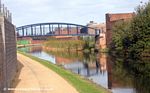
Burlington Street Bridge 1906 |
|
 |
 |
 |
 |
| Burlington Street Bridge |
Burlington Street Bridge |
Burlington Street Bridge |
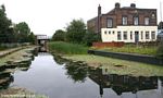
Eldonian Basin moorings |
 |
 |
 |
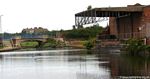 |
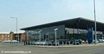
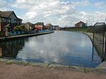
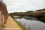
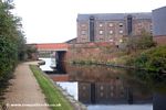
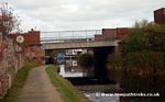
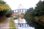
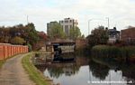
| The current terminus of the Leeds & Liverpool Canal |
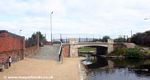
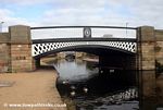
Vauxhall Bridge |
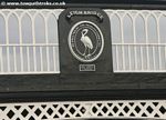
Date on Vauxhall Bridge |
Covered wharf of Canned Goods Factory |
|
 |
Enter the Stanley Dock Branch |
 |
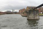
| Mainline looking towards the terminus, right to the Stanley Dock branch with former bridge support |
|
|
Mainline looking north to Bridge C |
 |
 |
 |
 |
Lightbody Street
Bridge C |
Leigh Bridge D |
Leigh Bridge D |
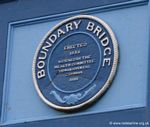
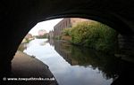
Boundary Bridge E |
 |
 |
 |
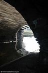 |
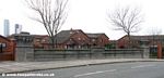
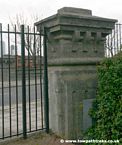
| Boundary Bridge E |
Boundary Bridge E |
Boundary Bridge E |
Boundary Bridge E |
|
 |
 |
 |
L'Pool 1 Mile
Leeds 126¼ Miles |
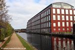
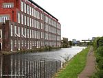
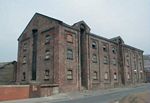
Tobacco warehouse |
Tobacco warehouse |
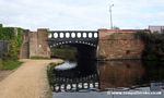
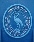
Sandhills Bridge F |
 |
 |
 |
|
| Sandhills Bridge F |
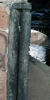
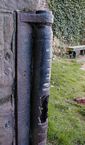
Metal Bridge Roller |
Metal Bridge roller |
|
Sandhills station on the Northern Line is a short walk from Sandhills Bridge. |
 |
 |
 |
 |
| Sandhills |
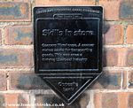
Info Plaque |
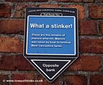
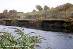
Manure Wharves |
Bridge H |
 |
 |
 |
 |
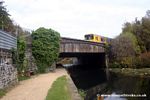
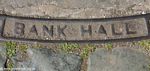
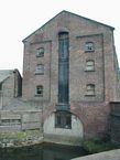
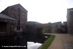
| Bank Hall |
Info Plaque |
Bank Hall Bridge I |
Bank Hall Warehouse |
Bank Hall Station on the Northern Line is within walking distance of Bank Hall Bridge I |
 |
 |
 |
 |
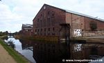
Bank Hall Warehouse
note the blocked off loading arm underneath the warehouse. |
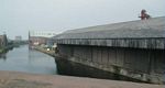
Covered Warf from Bridge I looking towards Bridge K
|
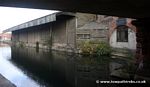
under Bank Hall Bridge |
Bank Hall looking towards Bridge I |
 |
 |
 |
 |
| Bank Hall looking towards Bridge I |
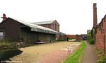
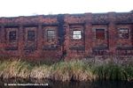
Engine Works |
Ruined Engineering Works |
Bridge K |
 |
 |
 |
 |
| Bridge L |
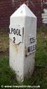
L'Pool 2 Miles
Leeds 125¼ Miles |
Douglas Place |
Millers Bridge M |
 |
 |
 |
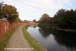 |
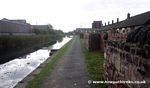
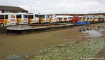
| Buses and a weedy canal |
Coopers of Canal Street |
Bridge Ma |
Bootle |
 |
 |
 |
|
Coffee House Bridge O
|
Bridge P in distance, The Warfe Inn |
Bridge P and #1 |
|