


Maghull to Burscough
12- 24 miles
Burscough
to Wigan
24 - 34 miles
Former Lancaster
Canal South
37-47miles
Johnson's Hillock
to Cherry Tree
47 - 54 miles
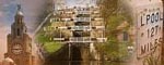
127.25 miles
Miles to Liverpool |
Places |
Towpath Condition |
Maps | Description |
Liverpool City Centre |
|
 |
The former canal basins are in Liverpool city centre at Pall Mall and Old Hall Street. |
|
1 - 2 |
Sandhills |
 |
|
The canal passes old warehouses and former industry. |
2 - 3 |
Bootle |
|
|
A quiet stretch of canal, a mixture of residential and former industry. Bridge 1 has quite steep cobbled slopes. |
3 - 4 |
Bootle |
|
|
Leaving Bootle Strand the canal passes behind industrial units and wasteland. Take care on bridge 2A as you cross the canal. |
4 - 5 |
Litherland |
 |
|
The canal passes rows of houses and a new tescos supermarket. Anti-vehicle gates on towpath |
5 - 6 |
Rimrose Valley Country Park |
 |
|
The canal runs alongside the country park with new housing on the far bank. |
6 - 7 |
Gorsey Lane |
 |
|
A mixture of new housing and old council estates. |
7 - 8 |
Netherton |
 |
|
The council estates intrude onto the canal at bridges. Anti-vehicle gates on towpath, you may have to dismount. |
8 - 9 |
Old Roan |
 |
|
Housing estates back on to the canal. Anti-vehicle gates on towpath |
Aintree Race Course |
|
|
The backgardens of houses back on to the towpath while Aintree Race Course is on the far side. Anti-vehicle gates on towpath |
|
10 - 11 |
M57 |
|
|
The canal is on an embankment above scrub and wasteland. It passes under the M57 |
11 - 12 |
Melling |
|
|
The canal passes the fields below Melling |
12 - 13 |
Maghull |
Worn Tarmac Cobbles |
The canal enters Maghull with houses, the backs of shops and playing fields bordering the canal. Drapers Bridge 11B gives access to Maghull Station. Anti-vehicle gates on towpath |
|
13 - 14 |
Red Lion Bridge |
Worn Tarmac Compact Mud |
The backgardens of Maghull run down to the canals edge, after the Running Horses pub there are fields to the west. |
|
14 - 15 |
Lydiate |
 |
The boats of the MMBC are moored along here, with a high hedge and trees lining the towpath. |
|
15 - 16 |
|
 |
The fields grow a variety of produce, cabbages, corn, sunflowers and lavender. The towpath is grassy and the hedgerow can be overgrown. |
|
16 - 17 |
Downholland |
 |
Grassy towpath surrounded by fields |
|
17 - 18 |
Haskayne |
|
While the canal is never far from the main road this stretch is quiet and agricultural. |
|
18 - 19 |
Halsall |
|
Carpark by Halsall Warehouse bridge #25 near the Saracens Head pub. |
|
Scarisbrick |
 |
Small car parks at the former wharves at bridges #26 and #27. |
||
20 - 21 |
Scarisbrick Marina |
|
The woods of Scarisbrick Hall line one side and the boats of the MMBC and a large caravan park the other. Take care on the towpath west of Heatons Bridge a short section is collapsed. |
|
21 - 22 |
Heatons Bridge |
|
I would recommend considering using the roads instead of the towpath on this stretch |
|
22 - 23 |
Martin Lane |
|
|
I would recommend using the roads instead of the towpath on this stretch. |
23 - 24 |
New Lane Bridge |
 |
Towpath improves towards Burscough. There is a gate on the towpath West of Burscough, main gate may be open. From the Farmers Arms pub to Burscough Bridge the towpath has been improved. |
|
24 - 25 |
Burscough Bridge |
|
Burscough Bridge Station, on road parking. |
|
25 - 26 |
Lathom |
|
Some good sections of gravel, some grass with compacted mud. |
|
26 - 27 |
|
|
Mostly good, grass with thin tracks of compacted mud. |
|
27 - 28 |
Parbold |
|
|
Parbold Station is close to Parbold Bridge, small popular car park by Parbold Bridge, some on road parking. Pubs and shops in Parbold. |
28 - 29 |
|
|
Good towpath but can be muddy and slippy when wet. |
|
Appley Bridge |
 |
|
Between Appley Locks and Appley Bridge the towpath is being improved. There is a anti-motorbike gate on the Wigan side of Appley Bridge. |
|
30 - 31 |
|
 |
The canal has the railway on one side and the former Douglas Navigation on the other as it passes through fields. |
|
31 - 32 |
Dean Locks |
|
Take care on the slippy cobbles by the lock house next to the M6. |
|
32 - 33 |
Crooke |
|
The towpath is patchy, mostly a narrow path of compact ground with grass either side. |
|
33 - 34 |
Wigan Athletic FC |
 |
At Ell Meadow Lock the cycle path starts. This is a smooth brick surface all the way to Wigan. |
|
34 - 35 |
Wigan Pier |
|
|
The canal enters Wigan and the famous Wigan Pier. Take care passing under Pottery Bridge#51 |
35 - 36 |
Bottom Lock Wigan |
|
Good paved towpath. |
|
36 - 37 |
Top Lock Wigan |
Canal and towpath head up the flight of 21 locks. |
||
37 - 38 |
|
|
||
38 - 39 |
|
|
||
39 - 40 |
|
|
||
|
|
|||
41 -42 |
|
|
||
42 - 43 |
|
|
||
43 - 44 |
|
|
||
44 - 45 |
|
|
||
45 - 46 |
|
|
||
46 - 47 |
Botany Bay |
|
||
47 - 48 |
|
|
||
48 - 49 |
Top Lock Johnsons Hillock |
Limited on road parking by the Top Lock pub. |
||
49 - 50 |
|
|
||
50 - 51 |
|
|
||
51 - 52 |
|
|
||
52 - 53 |
|
|
||
53 - 54 |
|
|
||
54 - 55 |
|
|
||
55 - 56 |
|
|
||
56 - 57 |
|
|
||
57 - 58 |
Eanam Wharf |
Blackburn Station is within walking distance of Eanam Wharf. There is a large car park for rail users at the station. |
||
58 - 59 |
|
|
||
59 - 60 |
|
|
||
60 - 61 |
|
|
||
61-62 |
|
|
||
62-63 |
|
|
||
63-64 |
|
|
||
Half Way |
|
|
||
64-65 |
|
|
||
65-66 |
|
|
||
66-67 |
|
|
||
67-68 |
|
|
||
68-69 |
|
|
||
69-70 |
Hapton Bridge |
|
||
70-71 |
|
|
||
71-72 |
|
|
||
72-73 |
|
|
||
73-74 |
Burnley Embankment |
Large Tescos at the end of the Embankment. Bust station and car park at bottom of Embankment. |
||
74-75 |
|
|
||
75-76 |
|
|
||
76-77 |
|
|
||
77-78 |
Brierfield Wharf |
|
||
78-79 |
|
|
||
79-80 |
|
|
||
80-81 |
Barrowford Wharf |
|
||
81-82 |
|
|
||
82-83 |
|
|
||
83-84 |
|
|
||
84-85 |
|
|
||
85-86 |
|
|
||
86-87 |
|
|
||
87-88 |
|
|
||
88-89 |
|
|
||
89-90 |
|
|
||
90-91 |
|
|
||
91-92 |
|
|
||
92-93 |
Bottom Lock Banknewton |
|
||
93-94 |
|
|
||
94-95 |
Bottom Lock Gargrave |
|
||
95-96 |
|
|
||
96-97 |
|
|
||
97-98 |
|
|
||
98-99 |
|
|
||
99-100 |
|
|
||
100-101 |
|
|
||
101-102 |
|
|
||
102-103 |
|
|
||
103-104 |
Kildwick Wharf |
|
||
104-105 |
|
|
||
105-106 |
|
|
||
106-107 |
|
|
||
107-108 |
|
|
||
108-109 |
|
Good quality gravel / compressed mud |
|
|
109-110 |
|
Good quality gravel / compressed mud |
|
|
110-111 |
|
Good quality gravel / compressed mud |
|
|
111-112 |
Bingley Five Rise |
Good quality gravel / compressed mud |
|
|
112-113 |
|
Tarmac through Bingley |
|
|
113 -114 |
|
Good quality gravel / compressed mud |
|
|
114-115 |
|
Quality deteroriates through shipley to rough gravel / some rocks. |
Cycle style on the boundary between Saltaire and Shipley. |
|
115-116 |
|
The towpath becomes muddy and narrow after Shipley but this can be avoided by using the road running parallel. |
||
116-117 |
|
Compressed mud, can be messy after rain. |
|
|
117-118 |
Field Three Rise |
Medium quality gravel / compressed mud |
|
|
118-119 |
|
Good quality gravel / compressed mud |
|
|
119-120 |
|
Very rough rocky ground, ruts on both sides. |
|
|
120-121 |
|
Rough rocky gravel and compressed mud in places. |
|
|
121-122 |
Rodley Wharf |
Good quality gravel / compressed mud |
Several cycle styles in quick succession. |
|
122-123 |
|
Good quality gravel / compressed mud |
|
|
123-124 |
|
Good quality gravel / compressed mud |
|
|
124-125 |
|
medium to poor quality gravel / compressed mud - alternative cycle path. |
The sections running through Armley have become somewhat damaged and in 2010/11 have been replaced with a tarmacced cycle path which runs parallel to the canal towpath in some sections then rejoins the towpath in others. |
|
125-126 |
|
Good quality gravel / compressed mud |
|
|
126 -127 |
|
Patchy surface running in to leeds now with good quality towpath in most parts but with very badly damaged slopes with large rocks and ruts, quite technical. |
||
127-end |
Leeds River Lock |
Leeds easy access to the city centre and railway station. |
||
|
|


Shipley to Leeds
115 -125 miles
Stockbridge to Shipley
109 -115 miles
Skipton to Stockbridge
99 - 109 miles
Gargrave to Skipton
93 -99 miles
Greenberfield to Gargrave
87 - 93 miles
Foulridge to Greenberfield
82-87 miles